Split Rock Lighthouse
The North Shore's signature light station and history center.
Explore the place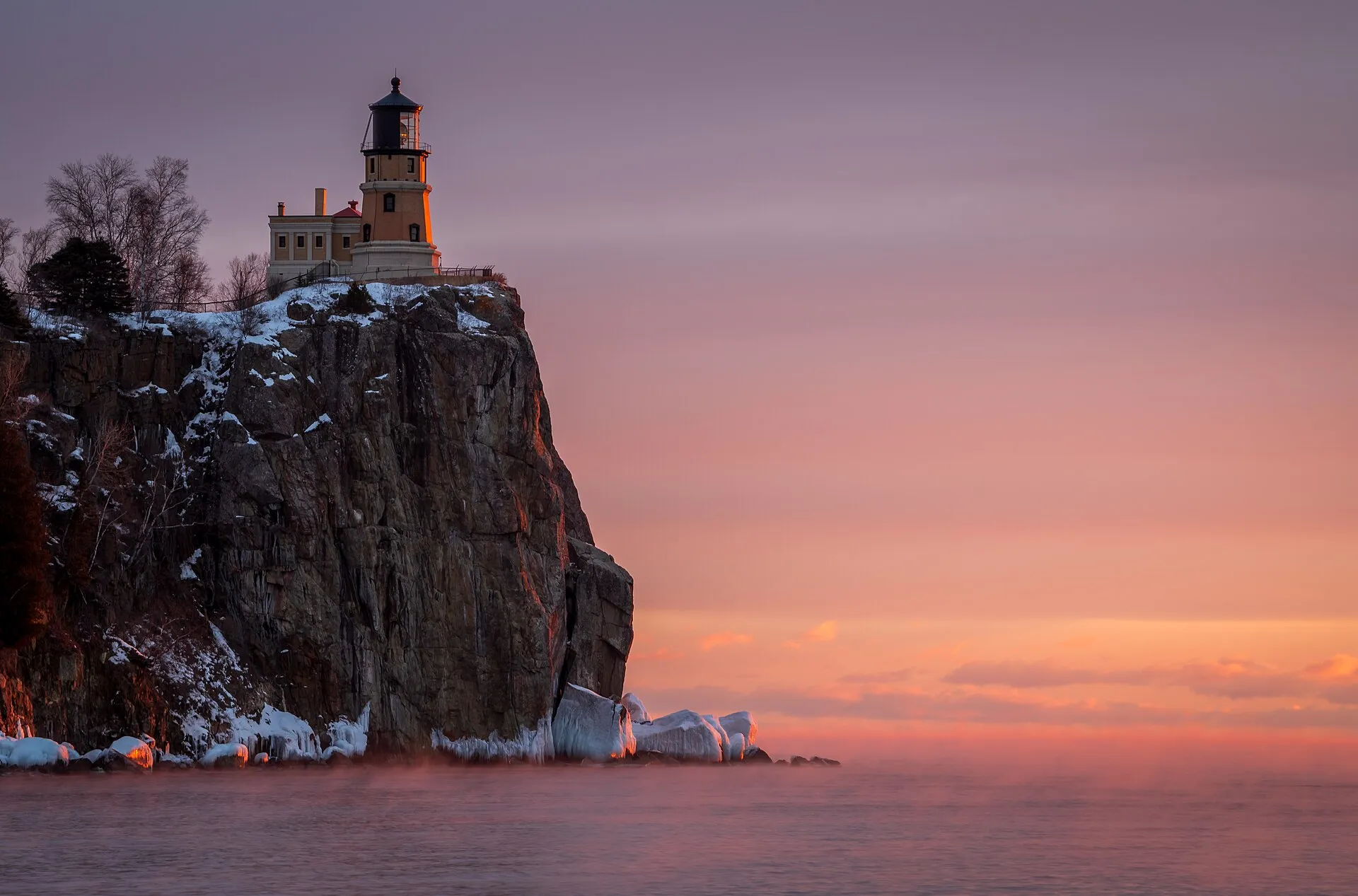
Great Lakes state
The North Shore and harbor country on Lake Superior.
Split Rock Light Station.jpg by MichaelDPhotos · CC BY-SA 4.0. Resized and converted to WebP; display crops vary.
Meet the coast
Minnesota's Great Lakes shoreline follows Lake Superior from Duluth toward the Canadian border.
Live · Minnesota
Weather, alerts, the water, the sky and local headlines, gathered from official sources as you read.
Gathering the latest conditions…
Highlights
The North Shore's signature light station and history center.
Explore the placeTiered waterfalls a short walk from the highway — busiest in spring melt.
Explore the placePalisade Head views, the Baptism River and a high cliff coastline.
Explore the placeWatch freighters pass under the Aerial Lift Bridge from Canal Park.
Explore the placePlan your time
Loading the map. The links and itinerary below are always available.
4 of 7 places mapped. 3 remain in the list without a map pin. Unverified locations and precise shipwreck sites are not plotted. Pins are representative locations, not verified entrances.
Black-and-white basemap by OpenStreetMap. Great Lakes highlighted in color. Hold Ctrl (or Command) while scrolling to zoom. Use two fingers on touch screens.
Lake outlines: Natural Earth (public domain). Town centers: GeoNames (CC BY 4.0). Not for navigation. Selecting Live ships loads an external VesselFinder map for this area. Privacy details.Along the shore
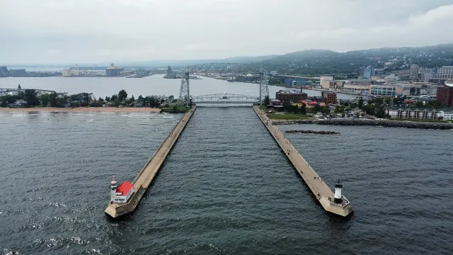 Coastal town
Duluth
A working harbor city at the western tip of Lake Superior.
Explore place
Duluth, MN - Aerial Lift Bridge and harbor, aerial, August 2024.jpg by Bspor.88 · CC0. Resized and converted to WebP; display crops vary.
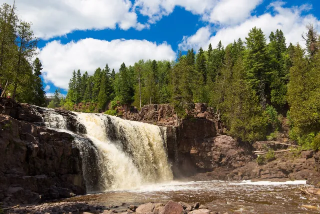 State Park
Gooseberry Falls State Park
Waterfalls, river trails and a rocky Lake Superior shore on Minnesota's North Shore.
Explore place
Middle Gooseberry Falls, Gooseberry Falls State Park, Minnesota.jpg by Edward Morrissey · CC BY-SA 4.0. Resized and converted to WebP; display crops vary.
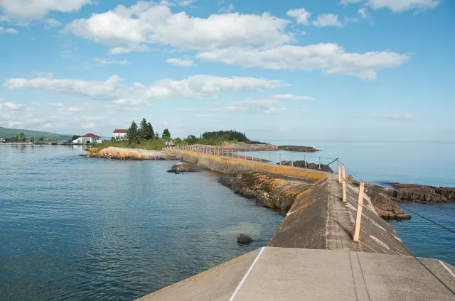 Coastal town
Grand Marais
An artist's harbor at the meeting of Lake Superior and the Gunflint Trail.
Explore place
North Shore Trip - Beautiful Grand Marais, MN (14969233032).jpg by Pete Markham from Loretto, USA · CC BY-SA 2.0. Resized and converted to WebP; display crops vary.
 Lighthouse
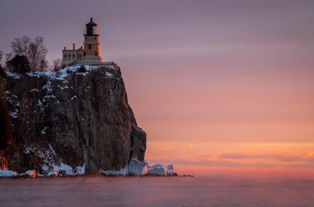
Split Rock Lighthouse
An iconic beacon perched above Minnesota's rugged North Shore.
Explore place
Split Rock Light Station.jpg by MichaelDPhotos · CC BY-SA 4.0. Resized and converted to WebP; display crops vary.
 State Park
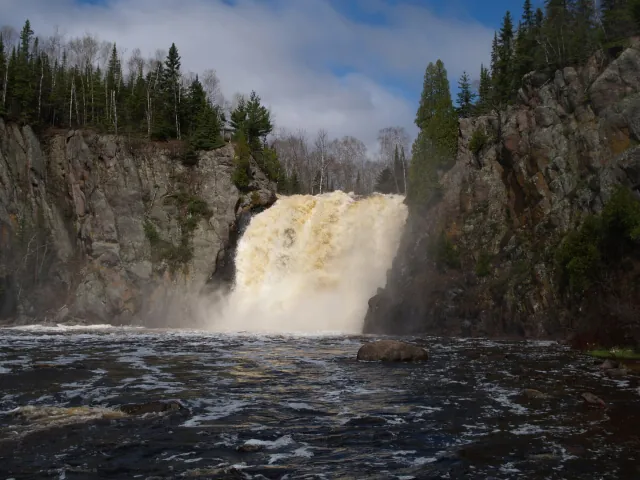
Tettegouche State Park
Clifftop Lake Superior scenery and forested river country.
Explore place
Northern MN Spring 2005 099.jpg by Desertson67 at English Wikipedia · CC BY-SA 3.0. Resized and converted to WebP; display crops vary.
 Coastal town
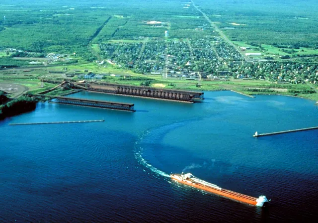
Two Harbors
Ore docks, a historic lighthouse and a working Lake Superior waterfront.
Explore place
Two Harbors Minnesota aerial view.jpg by U.S. Army Corps of Engineers, photographer not specified or unknown · Public domain. Resized and converted to WebP; display crops vary.
 Lighthouse
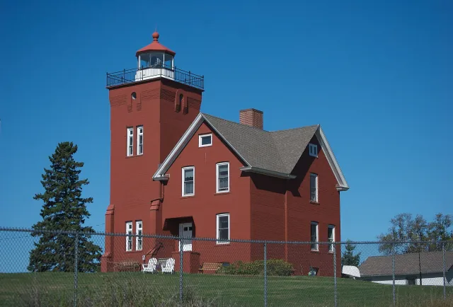
Two Harbors Lighthouse
A harbor light overlooking Minnesota's historic ore-shipping waterfront.
Explore place
Two Harbors Light Minnesota.jpg by pmarkham · CC BY-SA 2.0. Resized and converted to WebP; display crops vary.