Split Rock at sunrise
Minnesota's best-known light station crowns a cliff above the North Shore; walk the shoreline below for the classic view.
Explore this place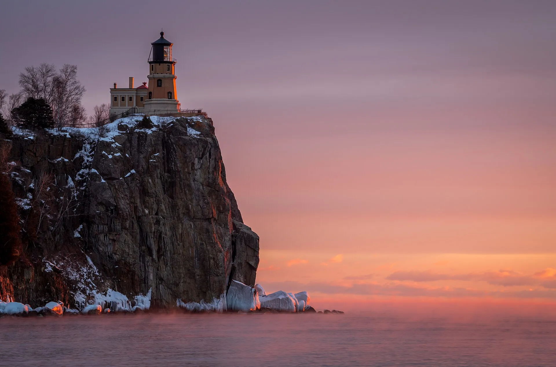
The Great Lakes · 01
Big water, rocky shorelines and the wild heart of the Great Lakes.
Split Rock Light Station.jpg by MichaelDPhotos · CC BY-SA 4.0. Resized and converted to WebP; display crops vary.
Follow the water
Superior is a lake of basalt headlands, sandstone cliffs, agate beaches and boreal forest. Its open water stays cold all summer, storms build quickly across hundreds of miles of fetch, and harbor towns are spaced far apart. Travelers who give it time are rewarded with some of the wildest coastline in North America.
U.S. EPA reference measurements; rounded, not current water levels.
Live · Lake Superior
Weather, alerts, the water, the sky and local headlines, gathered from official sources as you read.
Gathering the latest conditions…
Signature experiences
Minnesota's best-known light station crowns a cliff above the North Shore; walk the shoreline below for the classic view.
Explore this placePaddle with a guide or take a cruise among the 21 islands and wave-carved caves of the Apostle Islands.
Explore this placeMineral-streaked cliffs rise straight from the lake at Pictured Rocks; boat tours and overlooks show them at their best.
Explore this placeWhitefish Point's light station and museum tell the stories of the lake's most dangerous stretch of water.
Explore this placeTrails across the Sibley Peninsula climb to the cliffs of the landform that frames Thunder Bay's harbor.
Explore this placeAgawa Rock pictographs, cobble beaches and rugged trails line Lake Superior Provincial Park.
Explore this placeWhen to go
July through mid-September brings the warmest weather and fullest services. Late September and early October are prime for fall color on the North Shore and in the Upper Peninsula. Winter is for ice formations, snowshoeing and lake-effect snow — with many seasonal businesses closed.
Know the water
Superior's water rarely warms enough for comfortable swimming outside sheltered shallows in late summer. Cold-water shock is the main hazard: wear a life jacket on any boat, kayak or paddleboard, and save open-water paddling for guided trips or calm, well-forecast days.
Water safety & official forecastsLoading the map. The links and itinerary below are always available.
9 of 17 places mapped. 8 remain in the list without a map pin. Unverified locations and precise shipwreck sites are not plotted. Pins are representative locations, not verified entrances.
Black-and-white basemap by OpenStreetMap. Great Lakes highlighted in color. Hold Ctrl (or Command) while scrolling to zoom. Use two fingers on touch screens.
Lake outlines: Natural Earth (public domain). Town centers: GeoNames (CC BY 4.0). Not for navigation. Selecting Live ships loads an external VesselFinder map for this area. Privacy details.Along the shore
 National Lakeshore
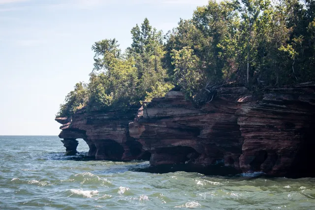
Apostle Islands National Lakeshore
A Lake Superior archipelago of forests, beaches, sea caves and lighthouses.
Explore place
Devil's Island Sea Caves (28462731415).jpg by Sharon Mollerus · CC BY 2.0. Resized and converted to WebP; display crops vary.
 Coastal town
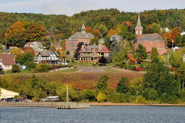
Bayfield
A small harbor town and gateway to the Apostle Islands.
Explore place
Bayfield Wisconsin.jpg by Dls4832 · CC BY-SA 4.0. Resized and converted to WebP; display crops vary.
 Coastal town
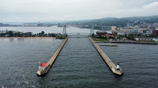
Duluth
A working harbor city at the western tip of Lake Superior.
Explore place
Duluth, MN - Aerial Lift Bridge and harbor, aerial, August 2024.jpg by Bspor.88 · CC0. Resized and converted to WebP; display crops vary.
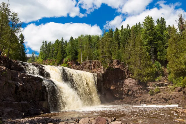 State Park
Gooseberry Falls State Park
Waterfalls, river trails and a rocky Lake Superior shore on Minnesota's North Shore.
Explore place
Middle Gooseberry Falls, Gooseberry Falls State Park, Minnesota.jpg by Edward Morrissey · CC BY-SA 4.0. Resized and converted to WebP; display crops vary.
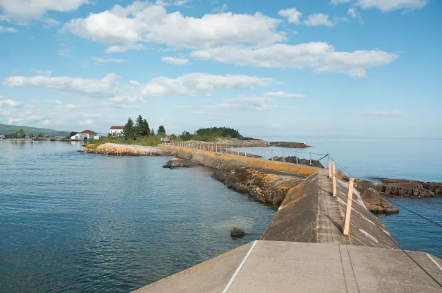 Coastal town
Grand Marais
An artist's harbor at the meeting of Lake Superior and the Gunflint Trail.
Explore place
North Shore Trip - Beautiful Grand Marais, MN (14969233032).jpg by Pete Markham from Loretto, USA · CC BY-SA 2.0. Resized and converted to WebP; display crops vary.
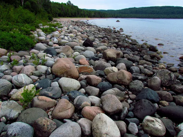 Provincial Park
Lake Superior Provincial Park
Ontario's eastern Lake Superior coast of bays, forest and rugged shoreline.
Explore place
Gargantua Harbour, Lake Superior PP.jpg by D. Gordon E. Robertson · CC BY-SA 3.0. Resized and converted to WebP; display crops vary.
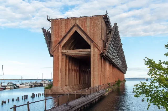 Coastal town
Marquette
A northern Michigan city with sandstone shoreline, trails and a historic ore harbor.
Explore place
Marquette Lower Harbor Ore Dock, 2013.jpg by ThiloG · CC BY-SA 2.0. Resized and converted to WebP; display crops vary.
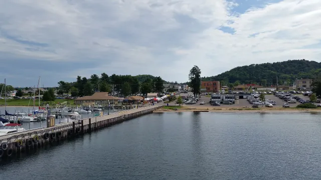 Coastal town
Munising
The harbor gateway to Pictured Rocks and a coastline of cliffs and waterfalls.
Explore place
Munising, Michigan (02 August 2016).jpg by Notorious4life · CC0. Resized and converted to WebP; display crops vary.
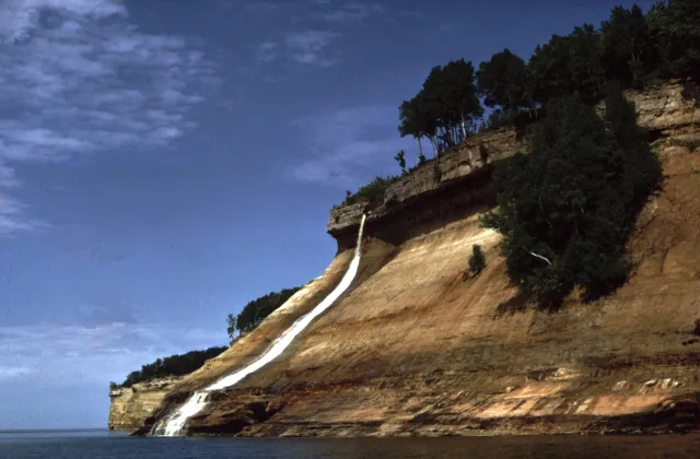 National Lakeshore
Pictured Rocks National Lakeshore
Sandstone cliffs, beaches and waterfalls along Michigan's Upper Peninsula.
Explore place
Pictured Rocks Bridalveil Falls.jpg by National Park Service · Public domain. Resized and converted to WebP; display crops vary.
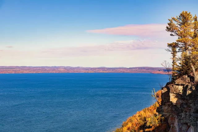 Provincial Park
Sleeping Giant Provincial Park
A forested Ontario peninsula with dramatic views of Lake Superior.
Explore place
Sleeping Giant Provincial Park Cliffs - Amethyst Harbour - Ontario - Canada in Autumn.jpg by Tony Webster · CC BY 2.0. Resized and converted to WebP; display crops vary.
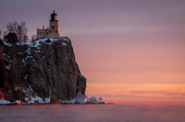 Lighthouse
Split Rock Lighthouse
An iconic beacon perched above Minnesota's rugged North Shore.
Explore place
Split Rock Light Station.jpg by MichaelDPhotos · CC BY-SA 4.0. Resized and converted to WebP; display crops vary.
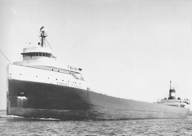 Shipwreck story
SS Edmund Fitzgerald
The Great Lakes' best-known shipwreck and a lasting story of Lake Superior.
Explore place
Edmund Fitzgerald-USACE.jpg by Unknown photographer · Public domain. Resized and converted to WebP; display crops vary.
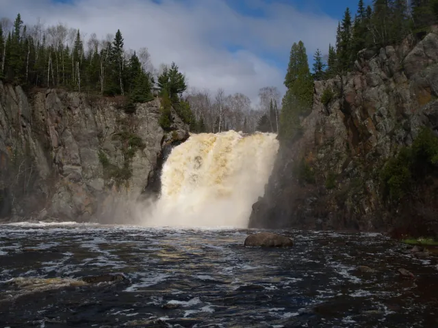 State Park
Tettegouche State Park
Clifftop Lake Superior scenery and forested river country.
Explore place
Northern MN Spring 2005 099.jpg by Desertson67 at English Wikipedia · CC BY-SA 3.0. Resized and converted to WebP; display crops vary.
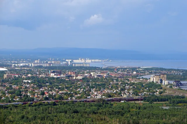 Coastal town
Thunder Bay
An Ontario port city facing the Sleeping Giant across Lake Superior.
Explore place
Thunder Bay skyline.JPG by P199 · CC BY-SA 3.0. Resized and converted to WebP; display crops vary.
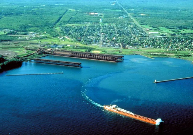 Coastal town
Two Harbors
Ore docks, a historic lighthouse and a working Lake Superior waterfront.
Explore place
Two Harbors Minnesota aerial view.jpg by U.S. Army Corps of Engineers, photographer not specified or unknown · Public domain. Resized and converted to WebP; display crops vary.
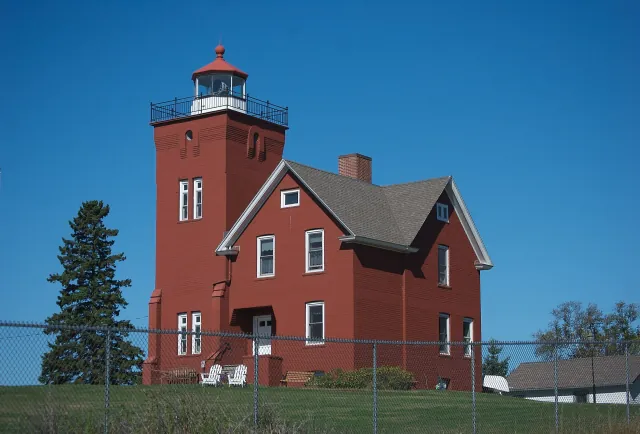 Lighthouse
Two Harbors Lighthouse
A harbor light overlooking Minnesota's historic ore-shipping waterfront.
Explore place
Two Harbors Light Minnesota.jpg by pmarkham · CC BY-SA 2.0. Resized and converted to WebP; display crops vary.
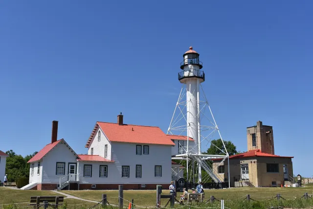 Lighthouse
Whitefish Point Light Station
A Lake Superior light station at a shoreline known for shipping and shipwreck stories.
Explore place
Whitefish Point Light 2026.jpg by TCP04 · CC BY 4.0. Resized and converted to WebP; display crops vary.
Did you know
Superior holds about 2,900 cubic miles of water — more than the other four Great Lakes combined, with room left over for three more Lake Eries.
A drop of water entering Superior stays, on average, for nearly two centuries before flowing on toward Lake Huron.
Its deepest point is 1,332 feet below the surface — far below sea level, even though the lake's surface sits about 600 feet above it.
Ships descend about 21 feet through the Soo Locks at Sault Ste. Marie when they leave Superior for the lower lakes.
Start a route with road trips on Lake Superior, or compare it with the other four lakes.