Explore the shoreline
Great Lakes coastal places
Find coastal towns, lighthouses, beaches, parks and maritime stories along the Great Lakes.
17 places in this view · Save a favorite or use the map to get your bearings.
Loading the map. The links and itinerary below are always available.
9 of 17 places mapped. 8 remain in the list without a map pin. Unverified locations and precise shipwreck sites are not plotted. Pins are representative locations, not verified entrances.
Black-and-white basemap by OpenStreetMap. Great Lakes highlighted in color. Hold Ctrl (or Command) while scrolling to zoom. Use two fingers on touch screens.
Lake outlines: Natural Earth (public domain). Town centers: GeoNames (CC BY 4.0). Not for navigation. Selecting Live ships loads an external VesselFinder map for this area. Privacy details.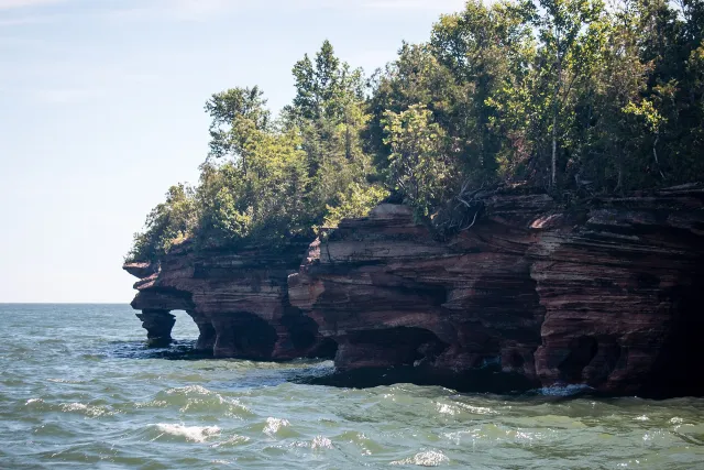 National Lakeshore
Apostle Islands National Lakeshore
A Lake Superior archipelago of forests, beaches, sea caves and lighthouses.
Explore place
Photo: Sharon Mollerus · CC BY 2.0
Devil's Island Sea Caves (28462731415).jpg by Sharon Mollerus · CC BY 2.0. Resized and converted to WebP; display crops vary.
 Coastal town
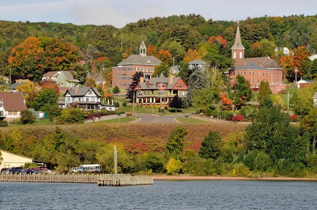
Bayfield
A small harbor town and gateway to the Apostle Islands.
Explore place
Photo: Dls4832 · CC BY-SA 4.0
Bayfield Wisconsin.jpg by Dls4832 · CC BY-SA 4.0. Resized and converted to WebP; display crops vary.
 Coastal town
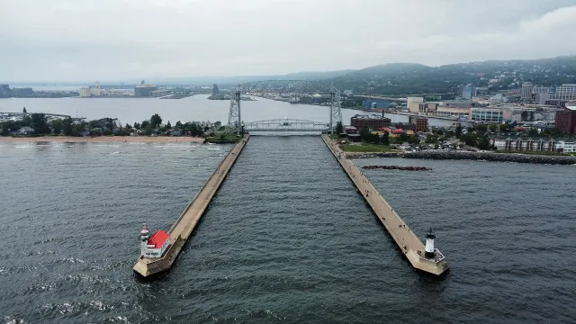
Duluth
A working harbor city at the western tip of Lake Superior.
Explore place
Photo: Bspor.88 · CC0
Duluth, MN - Aerial Lift Bridge and harbor, aerial, August 2024.jpg by Bspor.88 · CC0. Resized and converted to WebP; display crops vary.
 Lighthouse
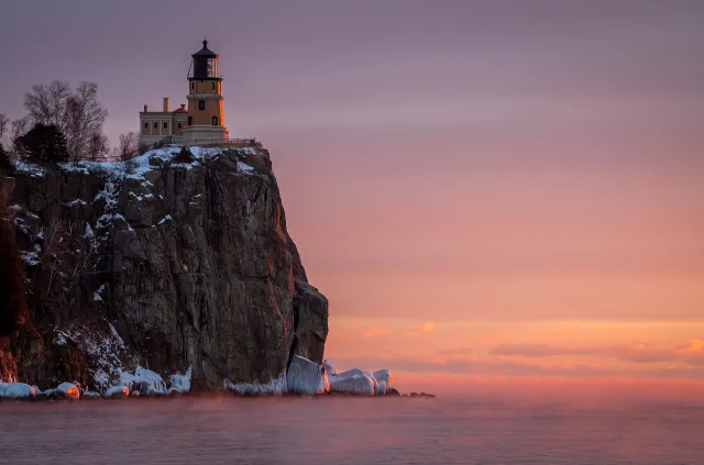
Split Rock Lighthouse
An iconic beacon perched above Minnesota's rugged North Shore.
Explore place
Photo: MichaelDPhotos · CC BY-SA 4.0
Split Rock Light Station.jpg by MichaelDPhotos · CC BY-SA 4.0. Resized and converted to WebP; display crops vary.
 Shipwreck story
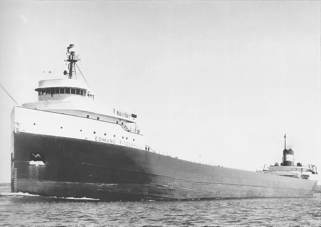
SS Edmund Fitzgerald
The Great Lakes' best-known shipwreck and a lasting story of Lake Superior.
Explore place
Photo: Unknown photographer · Public domain
Edmund Fitzgerald-USACE.jpg by Unknown photographer · Public domain. Resized and converted to WebP; display crops vary.
 State Park
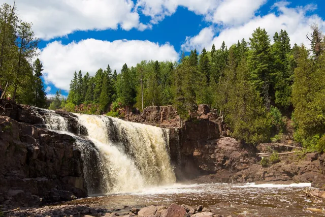
Gooseberry Falls State Park
Waterfalls, river trails and a rocky Lake Superior shore on Minnesota's North Shore.
Explore place
Photo: Edward Morrissey · CC BY-SA 4.0
Middle Gooseberry Falls, Gooseberry Falls State Park, Minnesota.jpg by Edward Morrissey · CC BY-SA 4.0. Resized and converted to WebP; display crops vary.
 Coastal town
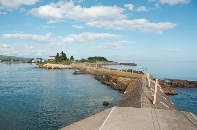
Grand Marais
An artist's harbor at the meeting of Lake Superior and the Gunflint Trail.
Explore place
Photo: Pete Markham from Loretto, USA · CC BY-SA 2.0
North Shore Trip - Beautiful Grand Marais, MN (14969233032).jpg by Pete Markham from Loretto, USA · CC BY-SA 2.0. Resized and converted to WebP; display crops vary.
 Provincial Park
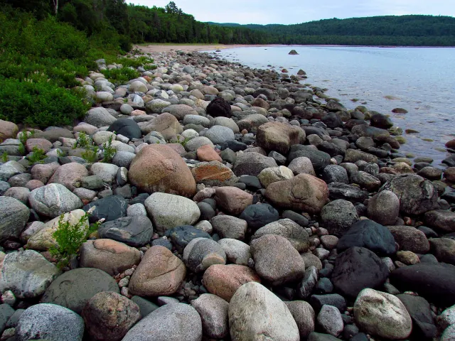
Lake Superior Provincial Park
Ontario's eastern Lake Superior coast of bays, forest and rugged shoreline.
Explore place
Photo: D. Gordon E. Robertson · CC BY-SA 3.0
Gargantua Harbour, Lake Superior PP.jpg by D. Gordon E. Robertson · CC BY-SA 3.0. Resized and converted to WebP; display crops vary.
 Coastal town
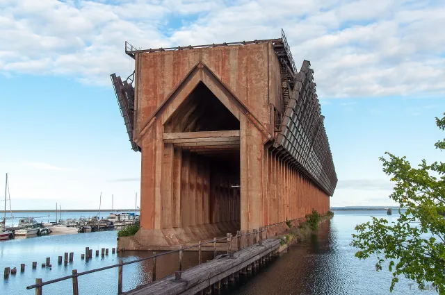
Marquette
A northern Michigan city with sandstone shoreline, trails and a historic ore harbor.
Explore place
Photo: ThiloG · CC BY-SA 2.0
Marquette Lower Harbor Ore Dock, 2013.jpg by ThiloG · CC BY-SA 2.0. Resized and converted to WebP; display crops vary.
 Coastal town
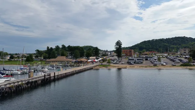
Munising
The harbor gateway to Pictured Rocks and a coastline of cliffs and waterfalls.
Explore place
Photo: Notorious4life · CC0
Munising, Michigan (02 August 2016).jpg by Notorious4life · CC0. Resized and converted to WebP; display crops vary.
 National Lakeshore
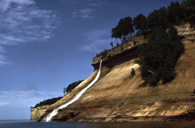
Pictured Rocks National Lakeshore
Sandstone cliffs, beaches and waterfalls along Michigan's Upper Peninsula.
Explore place
Photo: National Park Service · Public domain
Pictured Rocks Bridalveil Falls.jpg by National Park Service · Public domain. Resized and converted to WebP; display crops vary.
 Provincial Park
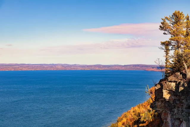
Sleeping Giant Provincial Park
A forested Ontario peninsula with dramatic views of Lake Superior.
Explore place
Photo: Tony Webster · CC BY 2.0
Sleeping Giant Provincial Park Cliffs - Amethyst Harbour - Ontario - Canada in Autumn.jpg by Tony Webster · CC BY 2.0. Resized and converted to WebP; display crops vary.
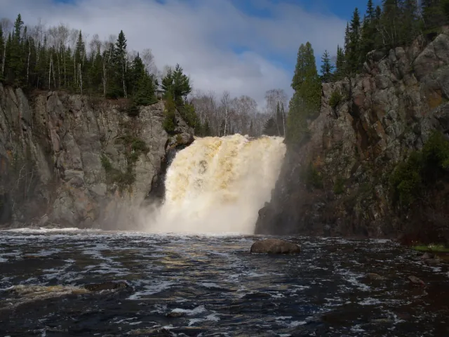 State Park
Tettegouche State Park
Clifftop Lake Superior scenery and forested river country.
Explore place
Photo: Desertson67 at English Wikipedia · CC BY-SA 3.0
Northern MN Spring 2005 099.jpg by Desertson67 at English Wikipedia · CC BY-SA 3.0. Resized and converted to WebP; display crops vary.
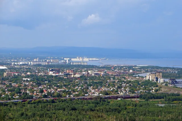 Coastal town
Thunder Bay
An Ontario port city facing the Sleeping Giant across Lake Superior.
Explore place
Photo: P199 · CC BY-SA 3.0
Thunder Bay skyline.JPG by P199 · CC BY-SA 3.0. Resized and converted to WebP; display crops vary.
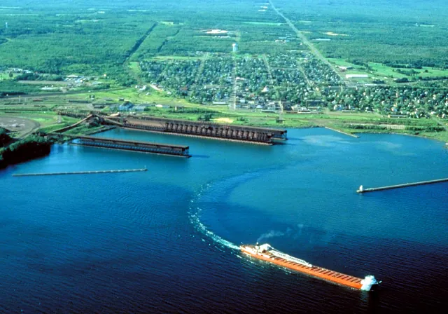 Coastal town
Two Harbors
Ore docks, a historic lighthouse and a working Lake Superior waterfront.
Explore place
Photo: U.S. Army Corps of Engineers, photographer not specified or unknown · Public domain
Two Harbors Minnesota aerial view.jpg by U.S. Army Corps of Engineers, photographer not specified or unknown · Public domain. Resized and converted to WebP; display crops vary.
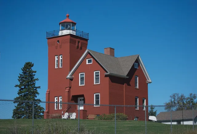 Lighthouse
Two Harbors Lighthouse
A harbor light overlooking Minnesota's historic ore-shipping waterfront.
Explore place
Photo: pmarkham · CC BY-SA 2.0
Two Harbors Light Minnesota.jpg by pmarkham · CC BY-SA 2.0. Resized and converted to WebP; display crops vary.
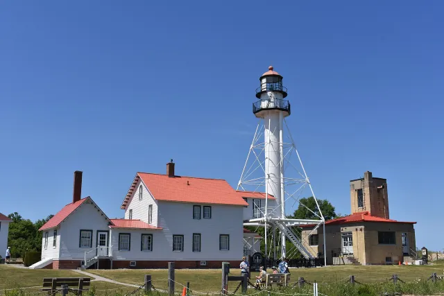 Lighthouse
Whitefish Point Light Station
A Lake Superior light station at a shoreline known for shipping and shipwreck stories.
Explore place
Photo: TCP04 · CC BY 4.0
Whitefish Point Light 2026.jpg by TCP04 · CC BY 4.0. Resized and converted to WebP; display crops vary.